
News & Insights
Follow our latest developments, stories, and technical resources.
2717


Publication
Leveraging SBOMs Throughout the Enterprise SDLC
News Release
MITRE Contributes Caldera to the Apache Incubator to Expand Open Cybersecurity Collaboration

MITRE 360
MITRE 360 May
Impact Story
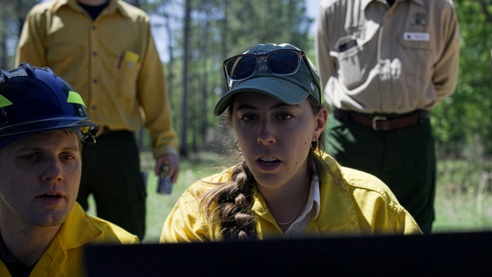
Advancing AI-Based Forecasts for Wildfire Management
Publication
2026 State of Warfighting Acquisition Survey

MITRE 360
MITRE 360 April
Media Inquiry
Reach out to us for media requests and public inquiries regarding MITRE—our work, our executive team, and our technical experts.
Events
View our noteworthy events either hosted by MITRE or where company representatives are active participants.