Until now, determining the orbit of satellites has required many measurements or multiple telescopes. A team of MITRE scientists took their equipment to Chile to view an eclipse—and proved an easier way.

MITRE Uses Earth Shadow to Determine Satellite Range
Sometimes a big idea starts this easily.
MITRE’s Kevin Schafer was with a group of engineers who specialize in satellite tracking, watching footage from the night before. As a satellite disappeared into the Earth shadow (the shadow that Earth itself casts onto its atmosphere and into outer space), one of the engineers said, “Hey, I bet we could use Earth’s shadow to figure out the range of satellites.”
Until now, using an optical telescope to determine range (distance) has been considered challenging. Schafer decided the Earth shadow idea had merit and created a project within MITRE's independent research program to test the concept. The theory was if they tracked and timed exactly when a satellite entered the Earth’s shadow, which is a known surface, they could determine the range.
Why is this important? Because optical sensors traditionally provide angles—but no range—data. Therefore, calculating satellite orbits optically requires more tracking time to achieve a given orbit accuracy than radar, which provides range. The problem is, radar is not only expensive, but easy for others to track.
So if this new theory worked, the MITRE team would be offering a less expensive and more secure way to determine the orbits of the ever-growing field of satellites circling the Earth. And that’s essential for a variety of reasons, including national security, the commercialization of space, growing need for Space Traffic Management, and the protection and safety of U.S. satellites, space vehicles, and their crews.
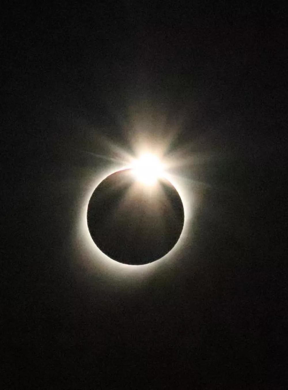
In July 2019, Schafer and his team of Tim McLaughlin and Chris Randell confirmed the hypothesis while observing a lunar eclipse from La Serena, Chile.
“We knew that the Earth’s atmosphere causes a fuzzy edge to Earth’s shadow, keeping us from precisely measuring when the satellites enter the Earth’s shadow. By using the moon’s shadow during an eclipse, we had the opportunity to make a clean measurement based on a crisp edge to the moon’s shadow.”
The team tracked GPS satellites, which provided exact location measurements. Schafer says, “That gave us a high degree of confidence in the accuracy of our data.”
This is a meaningful discovery. Schafer and his team have added a clever new technique using Earth shadow to determine range—and, with the sensor angles data, the orbit—of a satellite with a single optical telescope. Traditionally, determining range required many optical observations or the use of radar or lasers, both of which involved sending tremendous amounts of energy skyward.
Schafer adds this new method provides “a good-enough estimate to determine the orbit of a satellite—without expending all that energy.”
MITRE Invests in Optical Capabilities to Support New Mission
The “Earth Shadow” experiment was just one of several that MITRE conducted in Chile, either independently or at the request of sponsors. Schafer’s teammate, Randell, also came to Chile to oversee three of the experiments:
- Stereo viewing helps determine satellite range by (in this case) triangulating between Chile and a MITRE observatory in Colorado Springs.
- Earthshine measures the degree to which sunlight reflects off the Earth onto orbiting satellites.
- AllSky is a very wide-angle telescope. “Traditionally, using a telescope is like looking through a soda straw,” Randell says. “It’s a very narrow field of view, and that’s fine when you know exactly where to look. "But one of the things we’re helping our sponsors do is establish a wider range of view that can scoop up a great amount of data to help determine where to focus.”
Jody Mandeville, the team’s manager, provides some background about MITRE’s investments in optical capabilities, both in equipment and expertise.
“Back in 2012, we had already been supporting the U.S. Government space surveillance mission area for many years with modeling and simulation analysis [M&S] to determine the best ways to use those systems,” he says. “But we realized that if we added some hardware in the loop, then we could test some of what we were doing in M&S with actual systems.”
MITRE invested about $20,000 in this first telescope and set up a three-way partnership, including Peterson Air Force Base and the Air Force Academy. MITRE installed the telescope within a small dome owned by the Academy in Colorado Springs.
The partnership thrived, and they built two additional observatories at other locations in the Colorado Springs area. Currently, MITRE has about 10 projects underway that rely on these observatories.
“Primarily as part of a Cooperative Research and Development Agreement with the Air Force, the initial $20,000 investment has turned into about $1.5 million worth of equipment, three observatories, and the mobile capability of telescopes and equipment like what we took to Chile for research,” Mandeville says.
“We’re also transitioning technologies from small companies to help solve challenges for the Air Force and our other sponsors.”
Next Steps for Earth Shadow Concept
And as for the Earth shadow project? MITRE is encouraging companies to take an interest—to perhaps automate and, ultimately, commercialize it.
“We want people to take what we’ve started and bring it to the next level,” Schafer says. “This is a relatively inexpensive and easy way to identify the orbits of the many satellites circling the Earth. And that’s vital, given how space is rapidly becoming the new Wild West.”
—by Bill Eidson
Photo: Solar eclipse observed July 2019 from La Serena, Chile. Credit: MITRE’s Kevin Schafer.